Sociolinguistics meets archaeology: the LatinNow GIS

One of the planned outputs for LatinNow is a publicly accessible GIS. This will be an easily navigable web-based interface (similar to tools produced by ORBIS or EngLaId), which will display, amongst other things, inscriptions of the north-western Roman provinces as points on a map. Users will be able to search for inscriptions, filtering the data by e.g. location, date, and inscribed material; and then be able to display the text of the target inscription.

Fig01
Public-facing GIS tools from ORBIS and EngLaId

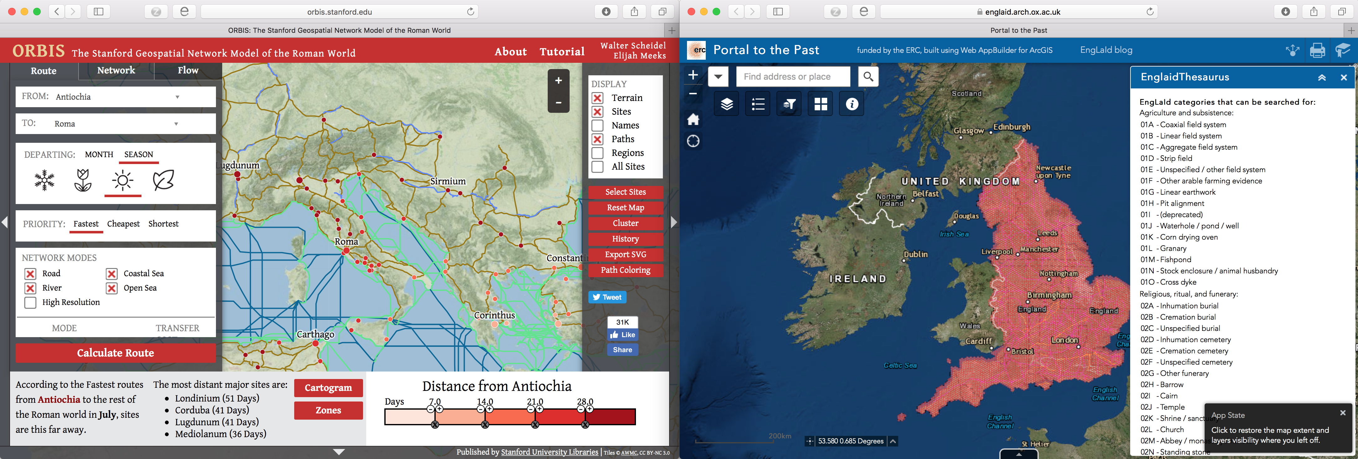
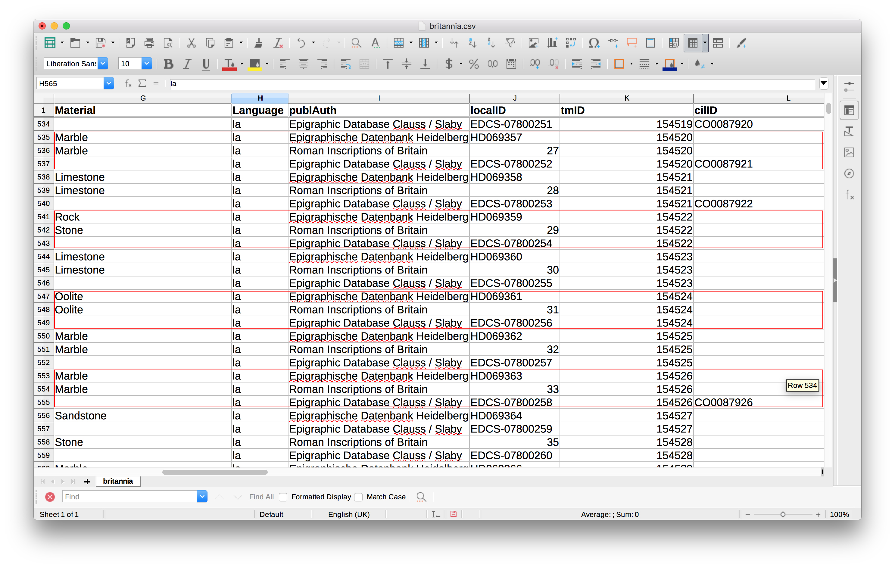
The data for the Latin and Greek inscriptions in this GIS comes from EAGLE, and comprises over 180,000 inscriptions marked up (largely through an automated process) with EpiDoc. With the help of our European Special Advisor Pietro Liuzzo, we obtained a collection of all the EAGLE files relevant to our provinces of study — i.e. the collection of ‘Classical’ language inscriptions which we can use in our GIS. However, it is not simply a case of dumping these files straight into a GIS: the collection contains multiple appearances of the same inscription in different Epigraphic corpora (e.g. Epigraphic Database Clauss Slaby; Epigraphische Datenbank Heidelberg; Roman Inscriptions of Britain), or even different editions/readings of the same text from the same corpus. We have also identified some problems with the automatic EpiDoc’ing process. For example, some of the files were EpiDoc’ed without geographic co-ordinates — essential references for displaying the data geospatially — and much work is therefore needed to make the data ‘GIS’ ready, either by manually adding in co-ordinates or linking the data up with Pleiades (where possible). The GIS team is currently dedicating most of its time to the cleaning and processing of the material in this way.

Fig02
Multiple entries for the same inscription from different Epigraphic corpora. Entries with the same ‘tmID’ refer to the same inscription.

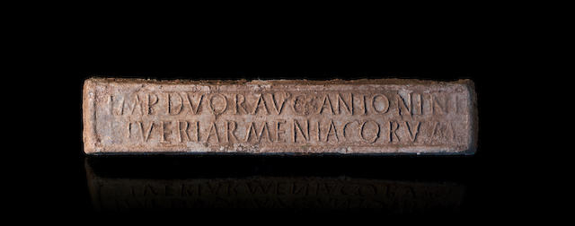
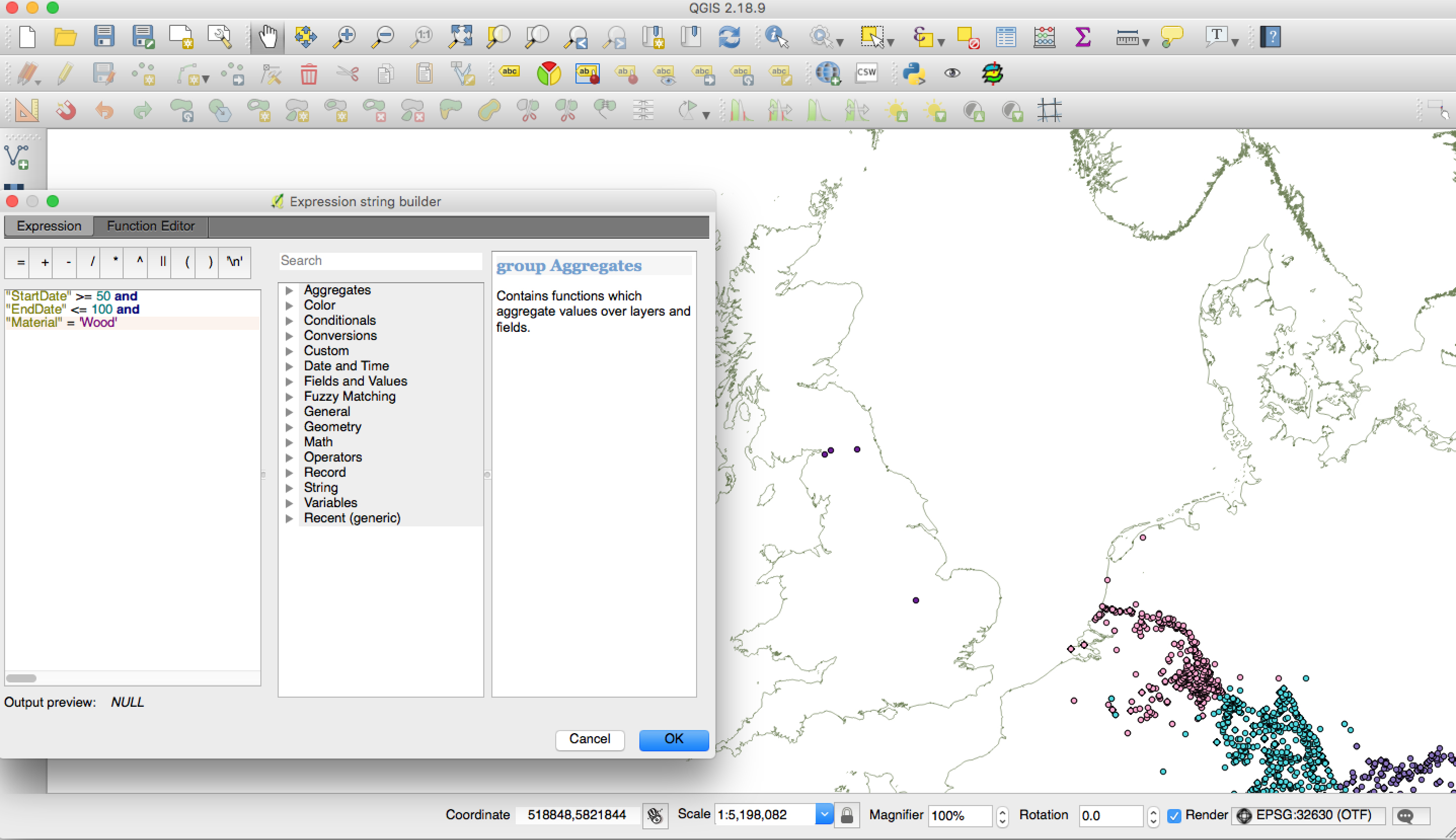
We do, however, already have a ‘dirty’ research version of the GIS, for use by the project team. We have been playing around with search queries, and have started to look for spatial patterns in the inscriptional record. As an example, here is a search which brought up inscriptions from Britain dated between AD 50–100 and written on wood. In addition, we have been visualising our inscription points against freely available GIS data from other projects (e.g. OxRep, PAS), in order to think about the social factors

Fig03
Screenshot of the ‘dirty’ data, from the Germanies, Noricum, and Raetia.

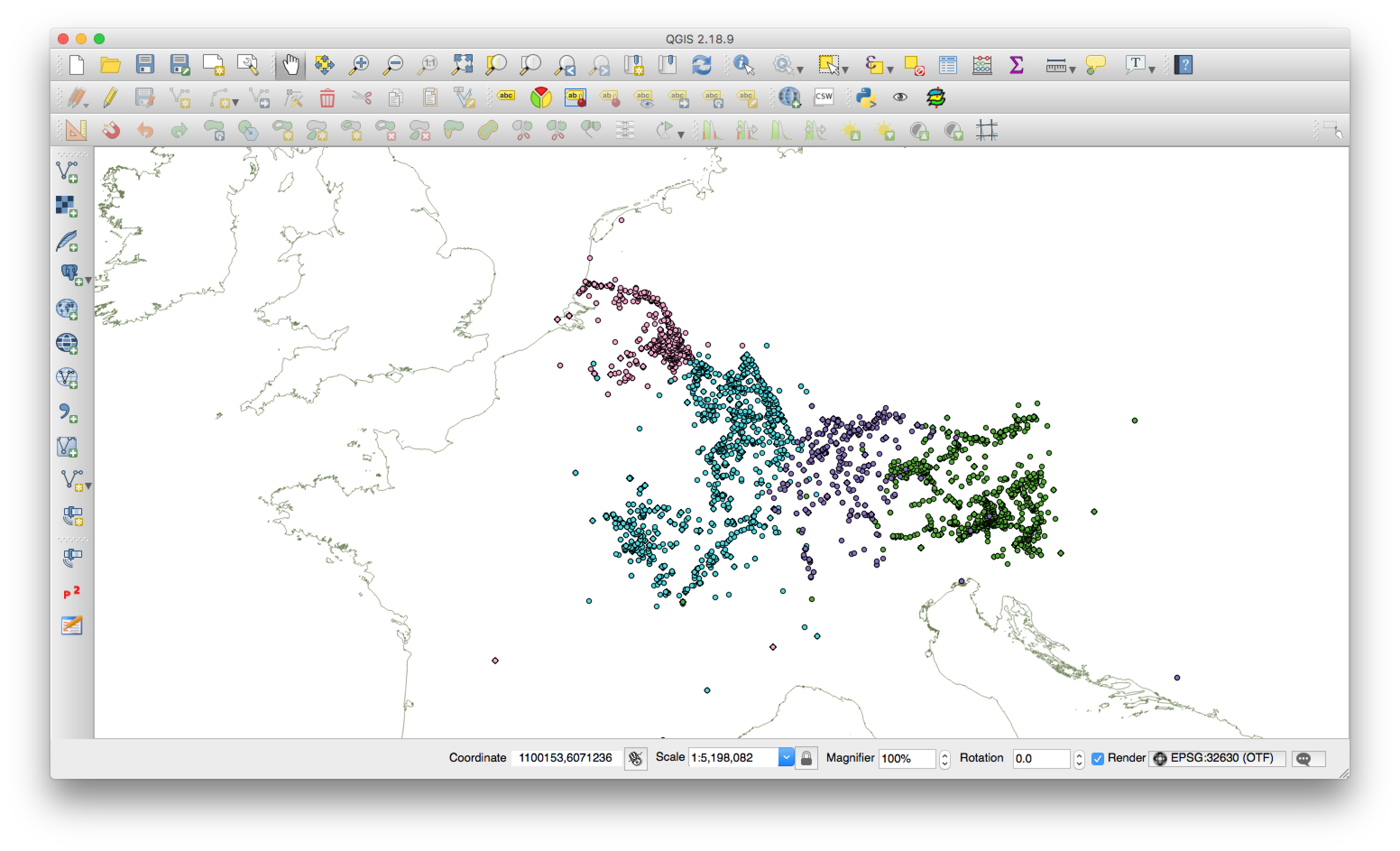
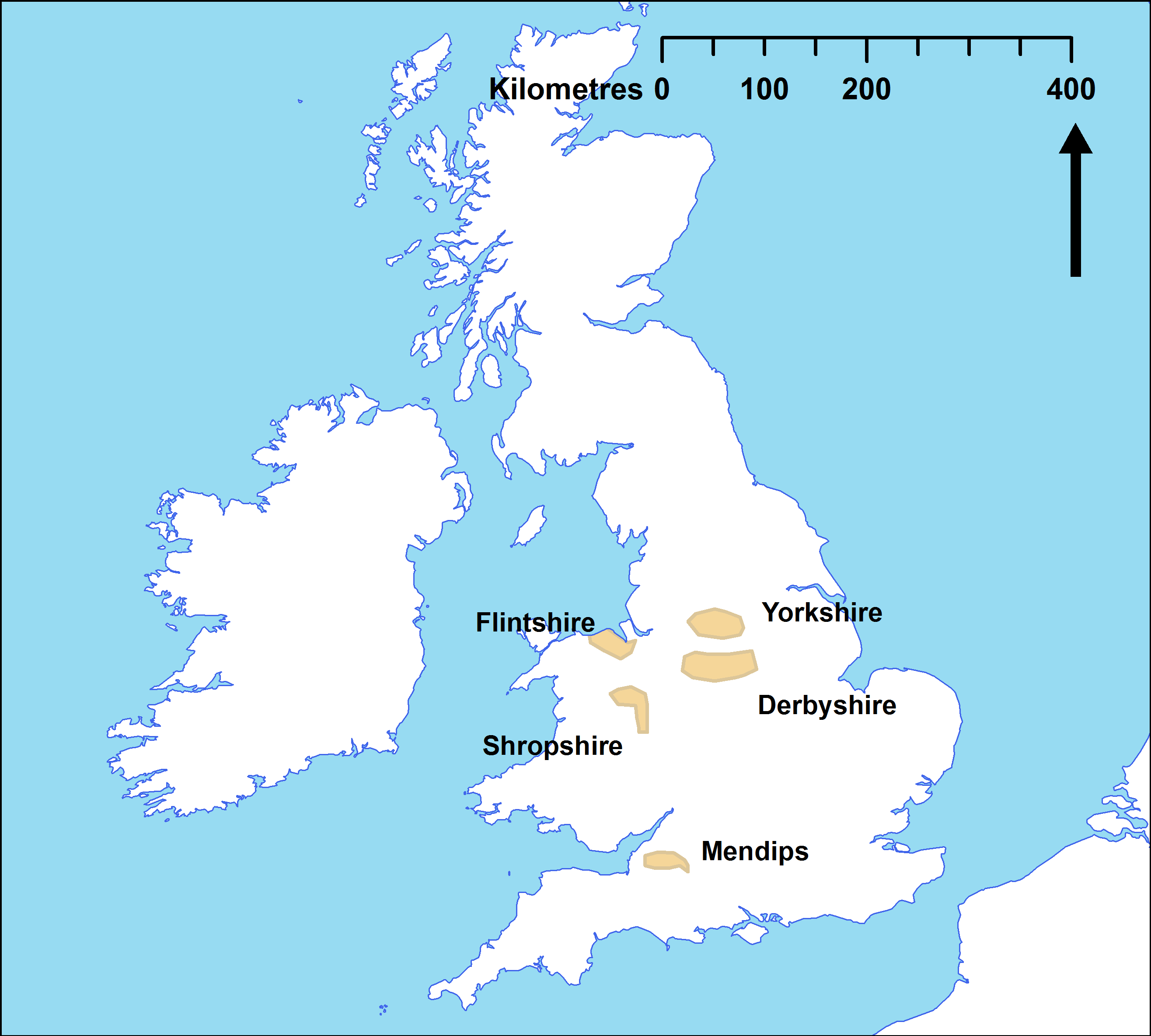
which might have affected the uptake and use of Latin. For example, do we find more stone inscriptions the closer we go to quarries? How does the epigraphic habit change with the movement of the military? What does the distribution of writing equipment tell us about literacy and Latinization in the various provinces? The quality of the data available is necessarily different across provinces, but the GIS allows us to ask questions about Latinization at various scales across the whole project area.

Fig04
Example query run on the inscriptions of Britannia. Here, inscriptions dated AD 50–100 and written on wood (missing, for example, the Bloomberg tablets, which have not yet been published online).

Work on the project GIS is ongoing. The main priorities at the moment are the cleaning of the EAGLE data; the addition of the non-Classical language inscriptions, and the input of more contextual data alongside our inscriptions.

This little Romano-British piggy went to market

You don’t necessarily need a Midas touch to turn lead into gold.

Last year, amateur metal detectorist Jason Baker made the news when he found a Romano-British lead ‘pig’ near his home in the Mendips, Somerset. A ‘pig’ is a large lead ingot, around half a metre in length, and usually inscribed with some sort of short Latin text. To his surprise, Mr Baker’s pig was expected to sell for around £60,000 – not bad for a bit of casual hobbying! In fact, many important archaeological finds connected with Roman Britain have been found in such a way by amateur enthusiasts. After having been registered and recorded properly by the Portable Antiquities Scheme (PAS), they constitute a large part of our primary evidence from this fascinating period of Britain’s history.

MendipsInsc.jpg

The pig in question reads:

IMP DVOR AVG ANTONINI
ET VERI ARMENIACORVM

https://romaninscriptionsofbritain.org/inscriptions/Brit.48.44

This refers to the emperors Marcus Aurelius and Lucius Verus, who reigned as co-emperors between AD 161-169. The title Armeniacus was an honorific adopted by both in recognition of their victories in the Parthian war. We know from other historical sources that Lucius Verus took up the title in AD 163 and Marcus Aurelius in AD 164, so this helps us to date the piece even more precisely to AD 164-169.

But an object like this can do a lot more for us than just dating: it tells us something about the Romano-British economy. Lead ore could be mined in Britannia in one of five locations across the province: Yorkshire, Derbyshire, Flintshire, Shropshire, and the Mendips. Pigs are often found near old Roman roads or rivers, and this suggests that they were transported by road or boat from the lead mines for market export. By analysing the type of ore against the distribution of pigs, we can therefore make some guesses about which regions supplied various the towns with their lead. The current assumption is that ore from the Mendip area was used across the whole south-west of Britannia, and that some was even exported to Londinium.

Britannia_Lead.png

A lead pig may not be the most glittering treasure, but it is a goldmine for telling us about the socio-economic factors which surrounded writing and object production in the second century AD.

This blog post has been written in order to support the content of the OCR Ancient History GCSE  topic ‘Community Life in the Classical World: Roman Britain’ and the OCR Ancient History A level module ‘Ruling Roman Britain’. It also links to KS2 national curriculum topics ‘Roman Britain’ and ‘Local History’

Further reading:

Elkington, D. 1976. The Mendip Lead Industry. in Branigan, K. & Fowler, P.J (edd.) The Roman West Country. London, David & Charles.

Gardiner, V. 2001. ‘An analysis of Romano-British lead pigs’ Institute for Archaeo-Metallurgical Studies Newsletter 21. 11-3
https://www.ucl.ac.uk/iams/newsletter/accordion/journals/iams_21/iams_21_2001_gardiner

Raistrick, A. 1931. ‘A Pig of Lead, with Roman inscription, in the Craven Museum’ Yorkshire Archaeological Journal 30. 181-2.

http://www.bbc.co.uk/news/uk-england-38027798


For more Roman inscriptions from Mendips, see:

RIB online 184, 185, and 186
https://romaninscriptionsofbritain.org/inscriptions/search?qv=mendip&submit=